
EN 10 · RSPB reserve guide
RSPB Titchwell Marsh
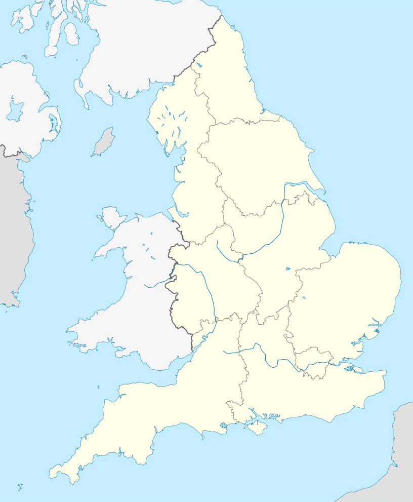
Titchwell, north Norfolk, England · PE31 8BB
Avocets, Bearded Tits and Marsh Harriers breed among a rare sequence of reedbed and freshwater and saltwater lagoons; migration can bring Ruff, sandpipers, Spoonbills and scarce coastal visitors.
Decide if the visit fits.
RSPB Titchwell Marsh at a glance
Last checked 9 October 2026.
- Best time
- Spring & autumn migration · rewarding year-round
- Opening & entry
- Hours, admission and parking: see Entry below.
- Trails & visit length
- The West Bank Path connects the visitor centre with the beach in 1.2 kilometres each way, passing reedbed, freshwater lagoon and saltwater habitats.
- Accessibility
- Most routes are flat and use boardwalk, rolled sand or gravel with regular passing places.
- Facilities
- The café offers hot and cold snacks, cakes, ice creams and drinks, with a covered eating area.
- Dogs
- Dogs on leads may use West Bank Path and the beach, and are welcome in the visitor hub and shop.
- Public transport
- Lynx Coastliner 36 is the direct bus option, running between King's Lynn, Hunstanton, Wells-next-the-Sea and Fakenham.
Reserve overview
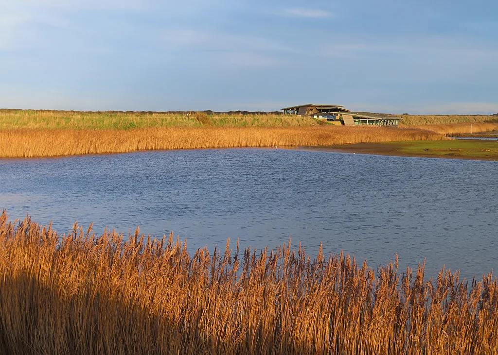
RSPB Titchwell Marsh reserve and habitat
Avocets, Bearded Tits and Marsh Harriers breed among a rare sequence of reedbed and freshwater and saltwater lagoons; migration can bring Ruff, sandpipers, Spoonbills and scarce coastal visitors.
Eight checks for a smoother visit.
Planning your visit to Titchwell Marsh
Conditions change: check the operator and transport notices before travelling.
Titchwell Marsh best time to visit and seasonal birds
January: Wigeon, Pintail and Golden Plover typically reward a slow scan from Island Hide. Continue to the beach end of West Bank Path for Common Scoter, Red-throated Diver and scarcer Long-tailed Duck; a telescope and a manageable sea are more useful than a rushed circuit.
February: Try South Parrinder Hide for Teal and Shelduck, then check Volunteer Marsh from North Parrinder for Grey Plover and Curlew. Brent Geese typically feed west of West Bank Path; calm conditions help with Bearded Tits along the reedbed.
March: Avocets and Black-tailed Godwits typically share Freshwater Marsh with remaining winter ducks; compare Island Hide and South Parrinder. Look for Marsh Harriers from the public West Bank reedbed section rather than following them towards their breeding areas. On a still morning, listen for a typically booming Bittern from the public West Bank reedbed section.
April: Start at Fen Hide for Reed and Sedge Warblers as spring song develops, then use Island Hide for Avocets and passage Black-tailed Godwits. South Parrinder can provide a different angle on feeding birds when glare makes the nearer hide awkward.
May: Bearded Tits and Reed Buntings typically repay a quiet West Bank reedbed stop, followed by Avocets and Common Terns from South Parrinder. View any breeding activity through the hide windows; the islands are not public walking areas.
June: Gadwall at Patsy’s Pool screen and Reed Warblers around Fen Hide provide a sheltered morning before the exposed lagoons. Avocets and Common Terns usually remain summer targets from South Parrinder; give feeding birds space and avoid playback.
July: Ruff and returning Black-tailed Godwits typically begin to enliven Island Hide while Common Terns remain active over Freshwater Marsh. Compare North Parrinder for Curlew, then consider the beach for Common Scoter if visibility allows careful identification.
August: Ruff, Spotted Redshank and Black-tailed Godwits are typical passage targets from Island Hide. The operator map marks Autumn Trail open August–October: use it only when signed open for a morning angle across Freshwater Marsh; try South Parrinder for Spoonbills.
September: Watch South Parrinder for Golden Plover and Spoonbill, then examine the Tidal Marsh from West Bank Path for Redshank and passage Greenshank. Offshore Red-throated Divers start becoming a more plausible seasonal target as autumn advances, with weather and visibility shaping the watch.
October: Golden Plover from Island Hide and Grey Plover from North Parrinder make a useful comparison. Bearded Tits typically become easier to detect calling along the West Bank reedbed; the beach can add Sanderling and Red-throated Diver without any expectation of rarities.
November: Try Island Hide for Pintail and Wigeon and North Parrinder for Curlew and Grey Plover. The beach end of West Bank Path is the place to work through Common Scoter and look for Red-throated Divers; keep a safe margin above waves and shortening daylight.
December: Use South Parrinder for Teal and Shelduck, Island Hide for Golden Plover, then Patsy’s Pool screen for Gadwall and Pochard. Winter woodland along Meadow Trail can hold Redwing and Siskin. For Marsh Harriers use public viewpoints and respect winter East Trail restrictions.
Best conditions: Typically choose calm mornings for reedbed calls and a clear, relatively flat sea for distant ducks and divers. The table’s light and scope choices are editorial advice from map orientation and viewing distance: east-facing Island Hide and West Bank views usually improve after midday. Strong onshore wind makes the beach exposed; use the lagoon hides instead.
RSPB Titchwell Marsh opening times, entry and facilities
Ordinary visits do not need advance booking; pay at the visitor centre. Current non-member admission is £8 for an adult, £4 for a child and £6 for a student with a valid NUS card. RSPB members, ages 16–24, under-fives, the first child and carers enter free. The published charges are for reserve admission; contact the reserve if you need a separate parking tariff. Visitor centre, shop and café are 09:30–16:30, and toilets 09:00–17:00. The facilities page states that the toilets close on Christmas Day and Boxing Day. No overnight parking or camping is allowed, despite the car park's round-the-clock opening. For a dawn visit carry what you need before the staffed buildings open and leave the longer exposed section until there is enough light.
Access times: Reserve: Open 24 hours on the October 2026 operator calendar. · Hides: Four hides listed open and Patsy’s screen open daily; no separate hide locking timetable published. · Car park: Open 24 hours; no overnight parking or camping. · Dawn access: yes. Operator opening information.
Titchwell Marsh trails, hides and visit length
The West Bank Path connects the visitor centre with the beach in 1.2 kilometres each way, passing reedbed, freshwater lagoon and saltwater habitats. Island, South Parrinder and North Parrinder hides let you compare the lagoon views. Fen Hide lies on the short Fen Trail, and Patsy's Reedbed screen provides another viewpoint away from the main line of walking. Fen Trail is about 200 metres; the Meadow boardwalk loop is about 100 metres. The East Trail adds quieter pool views. Two-hour plan: start with Island Hide, then choose a Parrinder hide for a longer watch. Scan the reedbed beside West Bank as you go and return without insisting on reaching the beach. This uses the reserve's main strength: several habitats close together, with time to learn the birds rather than simply walking past them. In spring, use a short Fen or Patsy's stop instead of chasing every lagoon viewpoint. Full-day plan: take West Bank to the beach in the morning, stopping at both freshwater and saltwater views. Spend a deliberate seawatch in suitable weather, then retrace the path for lunch. Give the afternoon to Fen, Meadow and the East Trail, finishing with a second lagoon watch to compare the birds and light. A full beach return is about 2.4 kilometres before the side trails and hide detours. Keep to paths and viewpoints: the apparent openness of the marsh does not make the islands or nesting edges walking routes. These are editorial self-led plans, with the order chosen to suit the day's birds and light.
Where to watch at Titchwell Marsh
Use the linked reserve map and directions with current access notices. Species are typical seasonal targets. Light and telescope advice reflects our choice of viewpoint.
| Spot | Overlooks | Key species by season | Best light | Scope | Tide |
|---|---|---|---|---|---|
| Island Hide | Freshwater Marsh islands and shallow margins | Winter: Wigeon, Pintail, Golden Plover Spring: Avocet, Black-tailed Godwit Summer: Avocet, Ruff Autumn: Black-tailed Godwit, Spotted Redshank | afternoon | useful | — |
| South Parrinder HideLevel, spacious hide with accessible viewing positions. | Freshwater Marsh from its northern bank | Winter: Teal, Shelduck, Water Pipit Spring: Avocet, Black-tailed Godwit Summer: Ruff, Common Tern Autumn: Spoonbill, Golden Plover | either | useful | — |
| North Parrinder HideLevel, spacious hide with accessible viewing positions. | Volunteer Marsh and its tidal creeks | Winter: Grey Plover, Curlew, Redshank Spring: Curlew, Redshank Summer: Curlew, Redshank Autumn: Grey Plover, Curlew | either | useful | Look for exposed creek mud as water falls; compare the Freshwater Marsh when tidal feeding areas are covered. |
| Fen HideUse the signed Fen Trail; public viewing only. | Reedbed pools and reed edges beside Fen Trail | Winter: Water Rail, Marsh Harrier Spring: Marsh Harrier, Bearded Tit Summer: Reed Warbler, Sedge Warbler Autumn: Bearded Tit, Little Egret | either | useful | — |
| Patsy’s Pool screenRamp or slope approach with low-level seating and wheelchair spaces. | Patsy’s Pool and the surrounding reedbed | Winter: Gadwall, Pochard Spring: Gadwall, Marsh Harrier Summer: Gadwall, Little Egret Autumn: Pochard, Marsh Harrier | either | useful | — |
| Harrier ViewpointFollow the current signed route; parts of the East Trail close in winter to protect roosting birds. | Reedbed north of the East Trail | Winter: Marsh Harrier Spring: Marsh Harrier Summer: Marsh Harrier Autumn: Marsh Harrier | either | useful | — |
| West Bank Path — reedbed section | Reedbed Pool, reed channels and Thornham Marsh | Winter: Brent Goose, Water Rail Spring: Bearded Tit, Marsh Harrier, Bittern Summer: Reed Bunting, Reed Warbler Autumn: Great White Egret, Bearded Tit | afternoon | not needed | — |
| West Bank Path — Tidal Marsh | Tidal Marsh and Volunteer Marsh creek margins | Winter: Black-tailed Godwit, Redshank Spring: Black-tailed Godwit, Redshank Summer: Curlew, Redshank Autumn: Black-tailed Godwit, Greenshank | afternoon | useful | An incoming tide changes available feeding mud; keep to the bank. |
| West Bank Path — beach endThe final bank and dune approach is steep and rough; use a safe firm position above the waterline. | The beach tideline and sea beyond the dunes | Winter: Common Scoter, Long-tailed Duck, Red-throated Diver Spring: Sanderling, Bar-tailed Godwit Summer: Common Scoter, Sandwich Tern Autumn: Red-throated Diver, Grey Plover, Sanderling | either | essential | Falling water exposes feeding sand; high water can bring resting waders towards shore. Do not follow flocks. |
| Meadow Trail | Sheltered woodland edge and short boardwalk near the visitor area | Winter: Siskin, Redwing Spring: Chiffchaff Summer: Chiffchaff Autumn: Redwing | either | not needed | — |
| Autumn TrailOperator map marks this route August–October only; obey current closures. | Freshwater Marsh from the eastern reedbed route | Summer: Ruff, Avocet Autumn: Black-tailed Godwit, Ruff | morning | useful | — |
Target species at Titchwell Marsh
Month chips show typical presence or our preferred viewing season. Choose birds that suit the time of your visit.
Headline birds
- JanFebMarAprMayJunJulAugSepOctNovDec
- AvocetIsland HideJanFebMarAprMayJunJulAugSepOctNovDec
- Marsh HarrierWest Bank Path — reedbed sectionJanFebMarAprMayJunJulAugSepOctNovDec
- Bearded TitWest Bank Path — reedbed sectionJanFebMarAprMayJunJulAugSepOctNovDec
Regular birds
- Black-tailed GodwitIsland HideJanFebMarAprMayJunJulAugSepOctNovDec
- Brent GooseWest Bank Path — reedbed sectionJanFebMarOctNovDec
- Golden PloverIsland HideJanFebMarAugSepOctNovDec
- Common ScoterWest Bank Path — beach endJanFebMarAprMayJunJulAugSepOctNovDec
- Red-throated DiverWest Bank Path — beach endJanFebMarOctNovDec
- Grey PloverNorth Parrinder HideJanFebMarOctNovDecAugSep
- CurlewNorth Parrinder HideJanFebMarAprMayJunJulAugSepOctNovDec
- RedshankWest Bank Path — Tidal MarshJanFebMarAprMayJunJulAugSepOctNovDec
- SanderlingWest Bank Path — beach endJanFebMarOctNovDecAprAugSep
- Bar-tailed GodwitWest Bank Path — beach endJanFebMarOctNovDecAprMayAugSep
- WigeonIsland HideJanFebMarOctNovDec
- JanFebMarAprMayJunJulAugSepOctNovDec
- ShovelerIsland HideJanFebMarAprMayJunJulAugSepOctNovDec
- PintailIsland HideJanFebMarOctNovDec
- ShelduckSouth Parrinder HideJanFebMarAprMayJunJulAugSepOctNovDec
- GadwallPatsy’s Pool screenJanFebMarAprMayJunJulAugSepOctNovDec
- PochardPatsy’s Pool screenJanFebMarOctNovDec
- Water RailWest Bank Path — reedbed sectionJanFebMarAprMayJunJulAugSepOctNovDec
- Great White EgretWest Bank Path — reedbed sectionJanFebMarAprMayJunJulAugSepOctNovDec
- Little EgretFen HideJanFebMarAprMayJunJulAugSepOctNovDec
- SpoonbillSouth Parrinder HideAprMayJunJulAugSepOct
- RuffIsland HideJanFebMarAprMayJulAugSepOctNovDec
- Common TernSouth Parrinder HideAprMayJunJulAugSep
- Sandwich TernWest Bank Path — beach endAprMayJunJulAugSep
- GreenshankWest Bank Path — Tidal MarshMarAprMayJulAugSepOct
- Reed WarblerFen HideAprMayJunJulAugSep
- Sedge WarblerFen HideAprMayJunJulAugSep
- Reed BuntingWest Bank Path — reedbed sectionJanFebMarAprMayJunJulAugSepOctNovDec
- SiskinMeadow TrailJanFebMarOctNovDec
- RedwingMeadow TrailJanFebMarOctNovDec
- ChiffchaffMeadow TrailMarAprMayJunJulAugSepOct
Scarce but regular birds
- Spotted RedshankIsland HideJanFebMarAprMayJulAugSepOctNovDec
- Long-tailed DuckWest Bank Path — beach endJanFebMarOctNovDec
- Water PipitSouth Parrinder HideJanFebMarOctNovDec
Tide planning
Freshwater Marsh is managed and does not require a particular sea tide. On the beach, falling water exposes feeding sand; from West Bank Path compare tidal creeks as mud is uncovered. Keep above the waterline and allow for wind-driven waves.
Titchwell Marsh accessibility and step-free routes
Most routes are flat and use boardwalk, rolled sand or gravel with regular passing places. Both Parrinder hides are level and spacious, with accessible viewing positions. Other viewpoints use ramps or slopes and provide a range of window heights. This is a strong reserve for a shorter accessible lagoon visit, but the final beach approach is a different surface from the main path. Near the sea defence bank there is a short steep slope. Beyond it the route becomes very rough, with a steep rough dirt track towards the dunes. Some East Trail sections also have loose surfaces. Choose the turn-around point according to the chair, scooter or pushchair rather than assuming the beach itself is equally easy to reach. The visitor centre is about 120 metres from the car park, with shallow sloped approaches and light manual doors without a threshold. The café has step-free double-door entry. Eight Blue Badge bays have a bonded-gravel surface, and accessible toilets are in the car park block. The car park is unlit and has no formal drop-off point. Accessible picnic seating is provided in the courtyard and between the car park and centre.
Titchwell Marsh visitor facilities
The café offers hot and cold snacks, cakes, ice creams and drinks, with a covered eating area. Bring a picnic if you want a longer beach watch rather than repeatedly returning for refreshments. The shop sells optics, books and nature gifts; binoculars and a telescope can be hired. Picnic tables and benches give places to rest across the visitor area. The toilet block includes baby changing. Bicycle racks are provided, and the reserve runs bookable guided walks and events.
Titchwell Marsh dog rules
Dogs on leads may use West Bank Path and the beach, and are welcome in the visitor hub and shop. Fen, East, Meadow and Autumn trails are for assistance dogs only. Keep dogs on leads throughout, including beside feeding shorebirds on the beach. Waste bins are in the car park and at the top of West Bank Path.
Titchwell Marsh public transport and getting there
Lynx Coastliner 36 is the direct bus option, running between King's Lynn, Hunstanton, Wells-next-the-Sea and Fakenham. It serves the RSPB Titchwell Marsh stop immediately outside the entrance on the A149. The current daytime pattern through this coastal section is broadly hourly, including published Sunday journeys, rather than the much more frequent combined services nearer King's Lynn. Routes 34 and 35 do not provide the equivalent through ride to Titchwell. For a rail arrival use King's Lynn station, then walk to the bus station or Transport Interchange for the 36. Hunstanton, Brancaster and nearby coast villages also offer a useful bus approach. Leave time to reach the correct direction's roadside stop for the return rather than finishing a beach watch at the bus departure time. National Cycle Route 1 passes within about two miles and the reserve supplies cycle racks. Arriving by car, follow the signed entrance off the A149 between Thornham and Titchwell. The measured town-to-reserve journeys below are driving estimates, distinct from the longer all-stops bus ride.
Useful bases for an early start.
Where to stay near Titchwell Marsh
Booking.com links are affiliate links: we may earn a commission at no extra cost to you. How these links work.
- 01
Titchwell
About 0.7 miles by road, roughly 5 minutes’ drive from Titchwell to the visitor arrival point. Check the final approach to your accommodation in Titchwell.
Measured driving route · 2026-10-09. Map estimates exclude live traffic.
Choose Titchwell for the earliest start; current Visit Norfolk listings include Briarfields Hotel in Titchwell and coastal self-catering around Brancaster.Find places to stay in Titchwell on Booking.com - 02
Brancaster
About 1.5 miles by road, roughly 5 minutes’ drive from Brancaster to the visitor arrival point. Check the final approach to your accommodation in Brancaster.
Measured driving route · 2026-10-09. Map estimates exclude live traffic.
Choose Brancaster for the earliest start; current Visit Norfolk listings include Briarfields Hotel in Titchwell and coastal self-catering around Brancaster.Find places to stay in Brancaster on Booking.com - 03
Hunstanton
About 5.5 miles by road, roughly 10 minutes’ drive from Hunstanton to the visitor arrival point. Check the final approach to your accommodation in Hunstanton.
Measured driving route · 2026-10-09. Map estimates exclude live traffic.
Best for seaside facilities and a broader choice of hotels and guesthouses, including current Visit Norfolk listings around Old Hunstanton.Find places to stay in Hunstanton on Booking.com - 04
King's Lynn
About 21.5 miles by road, roughly 30 minutes’ drive from King's Lynn to the visitor arrival point. Check the final approach to your accommodation in King's Lynn.
Measured driving route · 2026-10-09. Map estimates exclude live traffic.
Best for a car-free break, late rail arrival and combining Titchwell with other west Norfolk destinations.Find places to stay in King's Lynn on Booking.com
Titchwell Marsh official sightings, safety and contact
The reserve can be reached on 01485 210779 or titchwell@rspb.org.uk. The visitor address is Titchwell Marsh, Main Road, King's Lynn, Norfolk, PE31 8BB; the entrance is on the A149 rather than in King's Lynn itself. Use the official facilities and access guides when choosing a route for mobility needs. The RSPB reserve page links its social updates and events, while the live calendar separates unrestricted trail access from staffed facilities.
Recent sightings
Reports show what has been seen, not what will be.
- RSPB Titchwell weekly wildlife reportsoperator · updated weekly section; publication date not displayed
- Norfolk Ornithologists’ Association county newscounty club or recorder · updated usually daily; county news within Holme reports
Birding sources
- RSPB current reserve page and weekly sightings
- RSPB opening calendar
- RSPB hides, paths and access
- RSPB official trail map
- RSPB winter feature: habitats and specific viewing stops
- RSPB local-group report: 10 February 2024
- RSPB local-group report: 20 July 2025
- Norfolk Ornithologists’ Association sightings
- Norfolk Bird and Mammal Report availability
- UKHO tide-prediction station catalogue
- NOA dated county news: Titchwell Freshwater Marsh and Island Hide
Follow the BTO Birders’ Code and give wildlife space.
Best months for this reserve
Nearby complete guides.
Bird reserves near Titchwell Marsh
Stops with a purpose: use one as a contrasting habitat or weather-proof Plan B. Distances are straight-line estimates, not road journeys.
- About 9 miles away · A useful habitat changeHolkham National Nature ReserveWinter wildfowl · spring breeding birds · autumn migration
- About 9 miles away · A useful habitat changeRSPB SnettishamLate summer–winter
- About 15 miles away · A familiar habitatGibraltar Point National Nature ReserveSpring seabirds · autumn migration · winter coast